Introduction
The Amazon Basin is one of the most fascinating and essential ecological regions in the world. It is home to the largest tropical rainforest on Earth and cradles the mightiest river by discharge volume: the Amazon River. From its vast biodiversity to its influence on global weather systems, the Amazon Basin is a subject of intense study and growing concern due to environmental threats. This article provides a detailed, structured overview of the Amazon Basin’s location, climate, and river system, and explores the unique features that make this natural wonder crucial for the planet.
Amazon Basin Location
Where Is the Amazon Basin Located?
The Amazon Basin is located in South America and spans across nine countries: Brazil, Peru, Colombia, Venezuela, Ecuador, Bolivia, Guyana, Suriname, and French Guiana. However, the majority of the basin—approximately 60%—lies within Brazil. The basin covers an area of about 7 million square kilometers (2.7 million square miles), making it the largest drainage basin in the world. It is bordered by the Andes Mountains to the west and the Brazilian Highlands to the south and east. The northern boundary is defined by the Guiana Highlands.

Amazon Basin Location on World Map
On a world map, the Amazon Basin appears prominently in the northern part of South America, straddling the equator. Its central position on the continent places it in both the Northern and Southern Hemispheres. It stretches approximately from the eastern slopes of the Andes in the west to the Atlantic Ocean in the east. This equatorial location contributes significantly to its hot and humid tropical climate, which supports its lush rainforests.
Amazon Basin Climate
Tropical Rainforest Climate Characteristics
The Amazon Basin experiences a humid tropical rainforest climate (Af according to the Köppen climate classification). Average annual temperatures hover around 26 to 28 degrees Celsius (79 to 82 degrees Fahrenheit), with minimal seasonal variation. Rainfall is abundant and evenly distributed throughout the year, although some regions have more pronounced wet and dry seasons. Annual precipitation can range from 2,000 mm (79 inches) to over 3,000 mm (118 inches).
Influence on Global Climate Systems
The Amazon acts as a carbon sink, absorbing vast amounts of carbon dioxide and releasing oxygen, which is why it’s often called the “lungs of the Earth.” It plays a vital role in the Earth’s hydrological cycle by recycling about half of the rainfall through evapotranspiration. Any significant alteration to this cycle, such as deforestation or climate change, has the potential to disrupt global weather patterns and increase greenhouse gas concentrations.
Microclimates and Seasonal Variability
Despite its general classification as a rainforest, the Amazon Basin encompasses a variety of microclimates. For instance, higher altitudes near the Andes tend to be cooler, while lowland regions are more uniformly hot and wet. The rainy season in the western Amazon typically peaks from December to May, whereas in the eastern regions, it may extend into June.
The Amazon River System
Amazon River: In Which Country?
The Amazon River flows through several countries in South America. It originates in Peru, traverses through Colombia and Brazil, and finally empties into the Atlantic Ocean. Brazil holds the largest portion of the river, where it assumes its most voluminous form and provides an essential transportation route for remote communities.

Amazon River Length
The Amazon River is approximately 6,575 kilometers (4,345 miles) long, making it one of the two longest rivers in the world. There is an ongoing debate over whether the Amazon or the Nile is the longest river, depending on the identification of their respective sources. Regardless, the Amazon surpasses all other rivers in water discharge, pushing out more than 209,000 cubic meters (7.4 million cubic feet) per second during the rainy season.
Where Is the Source of the River Amazon?
The most widely accepted source of the Amazon River is the Nevado Mismi, a mountain in the Peruvian Andes. Located at an altitude of about 5,597 meters (18,363 feet), this glacial peak feeds the Apurímac River, which eventually merges with other rivers to form the Ucayali and then the main Amazon River. This discovery redefined earlier beliefs that the Marañón River was the principal source.
Where Is the Mouth of the Amazon River?
The mouth of the Amazon River is located on the northeastern coast of Brazil, where it discharges into the Atlantic Ocean. This mouth is not a single channel but a sprawling delta that spans hundreds of kilometers. The largest outlet is through the Marajó Island region, with several distributaries like the Pará and Tocantins Rivers contributing to the outflow. The width of the river at its mouth can exceed 300 kilometers (186 miles) during the wet season, creating a dramatic mixing zone of freshwater and seawater.
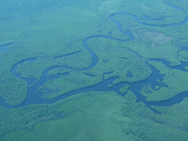
Amazon River Width and Flow Characteristics
The Amazon River is renowned for its exceptional width. In some places during the rainy season, it can reach widths of up to 50 kilometers (31 miles). Even in the dry season, the main channel can still span several kilometers. This immense width, coupled with its depth—sometimes exceeding 100 meters (328 feet)—makes it navigable for large vessels far inland. Its vast discharge also results in the unique “Pororoca” tidal bore, where ocean tides push upstream, creating waves that attract surfers.
Why Is the Amazon River Important?
The Amazon River is crucial for many reasons:
- Ecological Importance: It sustains the Amazon Rainforest, home to about 10% of the known species on Earth.
- Hydrological Role: It contributes roughly 20% of the world’s freshwater discharged into oceans.
- Cultural and Economic Significance: It supports millions of people, including indigenous communities, with resources, transport, and trade.
- Biodiversity Corridor: It acts as a natural highway connecting different habitats and enabling species migration.
Additionally, the Amazon River is a natural laboratory for scientific research, offering insights into climate resilience, adaptation, and biodiversity.
Interesting and Unusual Facts About the Amazon Basin
1. River Reversal Phenomenon
Due to the sheer volume of water during seasonal floods, the Amazon River can temporarily reverse the flow of its tributaries. This phenomenon causes vast inland lakes to expand, creating temporary habitats for aquatic species.
2. Underwater River
Researchers have discovered a subterranean river system flowing thousands of meters below the Amazon. Known as the Hamza River, this geological feature mimics the path of the surface Amazon and suggests complex hydrological interactions below ground.
3. Floating Forests
In floodplains known as várzea, forests can appear to float as rising waters submerge tree trunks. These ecosystems are uniquely adapted to seasonal flooding and support diverse flora and fauna.
4. Pink River Dolphins
One of the Amazon’s most iconic species is the Inia geoffrensis, or pink river dolphin. These intelligent mammals are revered in local folklore and are a key indicator species for river health.
5. Fire Risk Despite Rain
Though the basin is lush and wet, it is increasingly vulnerable to fires—often set for deforestation or agriculture. Droughts and rising temperatures exacerbate this risk, turning rainforests into tinderboxes.
6. Largest Floodplain Fish Migration
The Amazon hosts the world’s largest freshwater fish migration. Species like the tambaqui and pirarucu traverse hundreds of kilometers to spawn, driven by seasonal flooding and temperature cues.
7. Global Weather Influence
The moisture released by Amazonian trees contributes to cloud formation over the Atlantic, which in turn affects rainfall as far away as North America and Europe. The Amazon, therefore, plays a subtle yet essential role in global atmospheric circulation.
Conclusion
The Amazon Basin is not only a geographical marvel but also a linchpin of Earth’s environmental stability. Understanding its location, climate, and the dynamic Amazon River helps underscore its critical role in sustaining life—both regionally and globally. From its mysterious subterranean waterways to its vibrant wildlife and vital hydrological functions, the Amazon remains one of the most extraordinary natural systems on the planet. As global environmental challenges mount, safeguarding this basin becomes not just a regional concern but a planetary imperative.